The trip to Tunisia proved a most rewarding journey both in terms of photographs taken and in filling out certain blanks in my knowledge of ancient history of certain Mediterranean civilizations and present day conditions of a mainly agricultural country at the northernmost tip of North Africa with a very rich and complex history heavily influenced by its historical and cultural heritage from Semitic Canaanite Phoenicia, Italy, Turkey, southern Spain and France.
This an aerial photo taken from the internet of the very first stop of my 9-day tour: the ancient city of Carthage,(Arabic: قرطاج Qarṭāj, Berber: ⴽⴰⵔⵜⴰⵊⴻⵏ Kartajen and Latin: Carthago/Karthago ; Ancient Greek: Καρχηδών Karkhēdōn, Etruscan: Carθaza, from the Phoenician : Qart-ḥadašt, Aramaic: קרתא חדתא, Qarta Ḥdathin) meaning "New City" ie. the new Tyre ( Tyre being one of the two capitals of the Canaanite Phoenicans who were of mixed Jewish origin, the other being Sidon), now a suburb of Tunis (the capital of Tunisia) on the shores of Lake Tunis, home to slightly more than 20,000 people.
The Origin of Carthage
The origins of Carthage is fraught with problems because most of its own records were destroyed by the Romans at the end of the 3rd Punic War (see post), leaving just a few ancient translations of Punic texts into Greek and Latin. However, fortunately there are still some inscriptions on various standing monuments and buildings in various ruins. A number of mainly Greek and Roman historians have written about Carthage including Livy, Polybius, Appian, Cornelius Nepos, Silius Italicus, Plutarch, Dio Cassius, and Herodotus but they come from competing civlizations which were at war Carthage: the Greek cities fought with Carthage for control of the Western Mediterranean culminating in the Greek-Punic Wars over control of Sicily ( 1st: 480 BCE; 2nd: 410-340 BCE; 3rd: 315-307 BCE and the Pyrrhic War(280–275 BCE) and the Romans fought three wars against Carthage (see post), hence their accounts of Carthage are extremely hostile.
Carthage was at one time the capital of the Carthaginian Empire. According to Roman historian Justin, Carthage was founded by Queen Elissa( Greek: Dido), an exiled princess of Tyre, a city of Simitic Canaanites (in modern day Lebanon) in the mid 9th Century BCE.. Eleazar/Elissa was the daughter of King Belus II of Tyre who upon his death, passed the throne to her and her brother jointly. Once she got married to Acherbas (also known as Sychaeus), the High Priest of Melqart, a man with both authority and wealth comparable to her brother King Pygmalion, the latter began to suspect that Acherbas might use his religious influence to increase the power of his sister at his expense and he had him murdered in the Temple but kept this a secret from her sister. Upon discovery of the truth and fearing that sooner or later, Pygmalion might go after her too, she escaped to the present day Carthage. Legend has it that when she first arrived at the present day Carthage with her retinue, she asked for a piece of land and was told by the local Numibian ruler there that she couldn't land but after much pleading with him, he said that she could only have a piece of land as large as the perimeters of the skin of a cow. But she was undaunted. Very cleverly, she caused the skin of the cow to be cut into extremely thin strips as thin as pieces of fine threads and then joined them together end to end!
And according to the Roman poet Virgil (70-19 BCE) in the Aeneid, she was able to build a successful kingdom within 7 years. Through wise management of encouragement of sea trade and the use of mercenary armies (mainly local Numidians), this thalassocratic (sea empire) city-state, with a vast commercial network of friendly Greek and other Mediterranean city states, became a large and flourishing city and a major power in the Western Mediterranean Sea. The most important merchandise at that time was silver, lead, ivory and gold, beds and bedding, simple cheap pottery, jewellery, glassware, wild animals from African, fruit and nuts .Because of the discovery of tin mines in Britain by the Carthaginian, essential for the production of bronze, a closely guarded secret at that time, the Carthagians had an almost exclusive monopoly on that useful metal and this contributed greatly to their prosperity. Their navy included some 300 to 350 warships. which they produced serially via manufacturing cycles. At its height, it had influence or control of 300 cities around the Mediterranean coast and further inland. It had the largest navy in antiquity but had no large permanent standing armies, preferring to rely on mercenaries. The Carthaginians were famed for their abilities as sailors, and unlike their armies, many Carthaginians from the lower classes served in their navy, which provided them with a stable income and career.
According to Virgil, Eleazer's subjects adored her and presented her with a festival of praise. She is said to have offered political asylum to Aeneas and his men, who have recently escaped from Troy and a spirit in the form of Mercury, the messenger god sent by Jupiter, reminds Aeneas that his mission is not to stay in Carthage with his new-found love, Dido, but to sail to Italy to found Rome. Virgil ends his legend of Dido with the story that when Aeneas tells Dido, her heart broken, she orders a pyre to be built where she falls upon Aeneas' sword. As she lay dying, she predicted eternal strife between Aeneas' people and her own: "rise up from my bones, avenging spirit" (4.625, trans. Fitzgerald) she says, an invocation of Hannibal. The details of Virgil's story do not, however form part of the original legend and are significant mainly as an indication of Rome's attitude towards the city she had destroyed, exemplified by Cato the Elder's much-repeated utterance, "Carthago delenda est", "Carthage must be destroyed."
By the 6th century BCE Carthage had conquered the territory of the Libyan tribes and the old Phoenician colonies and had control over the North African coast, stretching from today's Morocco to the borders of today's Egypt, plus Sardinia, Malta, the Balearic Islands, and the western half of Sardinia. Carthage was fighting the Greeks and the Romans for control over Sicily and Sardinia. The war against the Greeks lasted more than 200 years, ending with success for Carthage
Conflict between Numibia, the Roman Empire and Carthaginian Empire: The 3rd Punic Wars & Complete destruction of Carthage
By 200 BCE the Roman Republic had gained control of the Italian peninsula south of the River Po. Unlike Carthage, Rome only had large disciplined armed forces but no significant navy. The rivalry between Carthage with Greek to control Syracuse ( at the eastern tip of Sicily) resulted in the Sicilian Wars and its rivalry with Rome for control of Sicily, Spain and Numidia ( see post) was accompanied by 3 so-called Punic Wars between Rome and Carthage from 264 BC to 146 BC ( the 1st: 264 to 241 BCE mainly naval but partly on Sicily & Africa in which Carthage lost the 2nd: 218 to 201 BCE fought out in Phoenician controlled southern Spain, Sicily and Italy in which Carthage lost again and the 3rd : 149-146 BCE fought in Carthage itself and resulting in its complete destruction) which were probably the biggest and longest wars that had ever taken place in ancient times. The term "Punic" in "Punic Wars" comes from the Latin word Punicus (or Poenicus), meaning "Carthaginian" because of their Phoenician ancestry.These wars were fought for the control of the Mediterranean Sea and the lucrative sea trade there because the Romans wanted to expand into the partly Carthagenian-controlled Sicily after its conquest of Greece which previously had control over the eastern part of the island. At the start of the 1st Punic War, Carthage was the dominant power of the Southern and Western Mediterranean ( the Eastern Mediterranean being the agreed sphere of influence of Greece) with an extensive maritime empire, while Rome was the rapidly ascending land power in Italy.
According to Polybius, Carthage relied heavily, though not exclusively, on foreign mercenaries, especially in overseas warfare. The core of its army was from its own territory in north Africa : ethnic Libyans and Numidians (modern northern Algeria), as well as "Liby-Phoenicians"—i.e., Phoenicians proper). These troops were supported by mercenaries from different ethnic groups and geographic locations across the Mediterranean who fought in their own national units; Celtic, Balearic, and Iberian troops were especially common. Later, after the Barcid conquest of Iberia (modern Spain and Portugal), Iberians came to form an even greater part of the Carthaginian forces. Carthage seems to have fielded a formidable cavalry force, especially in its North African homeland; a significant part of it was composed of Numidian contingents of light cavalry. Other mounted troops included the now extinct North African elephants, trained for war, which, among other uses, were commonly used for frontal assaults or as anti-cavalry protection. An army could field up to several hundred of these animals, but on most reported occasions fewer than a hundred were deployed. The riders of these elephants were armed with a spike and hammer to kill the elephants in case they charged toward their own army. At the start of the 1st Punic War the Romans had no navy to speak of and were thus at a disadvantage until they began to construct their own large fleets during the war. But they quickly manage to defeat Carthage by a combining reverse engineering of captured Carthaginian ships, recruiting experienced Greek sailors from the ranks of its conquered cities and their superior numbers in marines and rowers and the corvus device ( ingenious hinged bridge fitted with sharp spikes which they built at the bow of their ship and which they would lower at the head of the Carthaginian battleships and thus enable their own well disciplined army to rush on to the front of the Carthaginian ships and overcome them with their superior number and hand combating skills).
But by the end of the third war, after more than a hundred years and the loss of hundreds of thousands of soldiers from both sides, Rome had completely annihilated Carthagenian Empire and systematically destroyed that city. The Roman general Scipio Aemilianus and his men pulled the Phoenician warships out into the harbour and burned them before the city, and then went from house to house, capturing and enslaving the people. 50,000 Carthaginians were sold into slavery.The set the city on fire and razed it to the ground, leaving only ruins and rubble. After the fall of Carthage, Rome annexed the majority of the Carthaginian colonies, including other North African cities and territories like Volubilis, Lixus, Chellah, and Mogador.
The legend that the city was sown with salt is not mentioned by the ancient sources; R.T. Ridley suggested that the story originated from 1930 in section of the Cambridge Ancient History written by B Hallward whose influence might be an account of Abimelech's salting of Shechem in Judges 9:45. Warmington admitted his fault in repeating Hallward's error but mentions an example of the story that goes back to 1299 when Boniface VIII destroyed Palestrina.Whatever the truth may be, after Carthage was destroyed, Rome became the most powerful state of the Western Mediterranean.
With the end of the Macedonian Wars (214-148 BCE ) between Roman Empire and the Seluccids (see post) for the control of the Aegean Sea, the Adriatic Sea and the Balkans, which ran concurrently with the Punic Wars – and the defeat of the Seleucid King Antiochus III the Great in the Roman–Syrian War which concluded with the Treaty of Apamea, 188 BCE whereby Antiochus III had to pay 15,000 talents of silver as a war indemnity and was forced to abandon his territory west of the Taurus Mountains and lost much of his territories in Asia minor to the Roman allies in that war, Rome emerged as the dominant Mediterranean power and one of the most powerful cities in classical antiquity, a control which they retained for many centuries thereafter.
For a short time after Carthage was destroyed, the Romans made Utica a nearby rival of Carthage the capital of the region to replace Carthage as the leading center of Punic trade and leadership. It had the advantageous position of being situated on the Lake of Tunis and the outlet of the Majardah River, Tunisia's only river that flowed all year long. However, grain cultivation in the Tunisian mountains caused large amounts of silt to erode into the river. This silt accumulated in the harbor until it became useless and Rome was forced to rebuild Carthage. By 122 BC Gaius Gracchus founded a short-lived colony, called Colonia Iunonia, after the Latin name for the punic goddess Tanit, Iuno caelestis. The purpose was to obtain arable lands for impoverished farmers. But to undermine Gracchus' power, the Roman Senate abolished the colony some time later. After this ill-fated attempt a new city of Carthage was built on the same land by Julius Caesar in 5 years from 49–44 BC and by the 1st century CE. it had grown to be the second largest city in the western half of the Roman Empire, with a peak population of 500,000 and became the center of the Roman province of "Africa" which then became its breadbasket. It wasn't until February1985, that Ugo Vetere, the mayor of Rome, and Chedly Klibi, the mayor of Carthage, signed a symbolic treaty "officially" ending the conflict between their cities, which had supposedly been left without a formal peace treaty for more than 2,100 years !
The Seluccid Dynasty ( Greek controlled Babylonia) & Ptolemy ( Greek controlled Egypt)
The Seleccid Dynasty was first begun by Nicator (Seleucus I) when the empire created by Alexander the Great (who conquered the Persian Empire then under its last Achaemenid Emperor Darius III but died without an heir) was split into two after his death by his regent Perdiccas in the so-called Partition of Babylon in 323 BCE whereby Seleucus I (one of Alexander's generals) got Babylonia as satrap (a name given to the provincial governors of of the ancient Median, Archaemenid (Persian) Empires and their successors like the Sasanian Empires and the Hellenistic Empires) but who later assassinated him in collusion with Ptolemy, (another one of Alexander's generals who was made satrap of Egypt) who first started the revolt against Perdiccas after which the two agreed to a formal redivision of Alexander's empire under the Partition of Triparadisus in 320 BCE whereby Seleucus, who had been "Commander-in-Chief of the camp" under Perdiccas since 323 BC got Babylonia no longer as satrap but as its king and, from that point, he continued to expand his dominions ruthlessly finally establishing himself in Babylon in 312 BC, the year used as the foundation date of the Seluccid Empire. Seleucus ruled not only Babylonia but the entire enormous eastern part of Alexander's empire. According to the Roman historian Appian, he gradually "acquired control over Mesopotamia, Armenia, 'Seleucid' Cappadocia, Persis, Parthia, Bactria, Arabia, Tapouria, Sogdia, Arachosia, Hyrcania, and other adjacent peoples that had been subdued by Alexander, as far as the river Indus, so that the boundaries of his empire were the most extensive in Asia after that of Alexander. The whole region from Phrygia to the Indus was subject to Seleucus." and at its height even eastern Anatolia, the Levant, Kuwait, Persia, Afghanistan, Turkestan and northwest India. But the Seluccid Empire was greatly weakened after the Treaty of Apamea in 188 BCE after it lost its wars with Rome and survived merely because no other powerful states nearby wished to annex it, preferring to keep it as a buffer between themselves and their more powerful neighbors and the Seluccids retained control over little more than Antioch and some and some Syrian cities.
Numidia ( Libyan Berber predecessor of modern day Algeria, Libya & Morroco) & its part in the 2nd Punic War
Numidia (Tifinagh: ⵏⵓⵎⵉⴷⵢⴰ Numidya, 202 BC – 46 BC) was a Berber-Libyan kingdom in North Africa, in what is now Algeria and a smaller part of western Tunisia bordering the kingdom of Mauretania (modern day Morocco) to the west, the Roman province of Africa (present day Tunisia) to the east, the Sahara Desert to its south and the Mediterranean Sea to its north. At first, Numidia was ruled over in its eastern part by the Massylii and in its western part by Masaesyli until Massinissa, King of the Massylii, defeated Syphax of the Masaesyli and unified the kingdom but even after such unification, it alternated between being a Roman province and being a Roman client state. It is considered to be the first major state in the history of Algeria and the Berber world.The name Numidia was first applied during the 3rd century BCE by Roman historian Polybius and other historians to indicate the territory west of Carthage, including the entire north of Algeria as far as the river Mulucha (Muluya), about 100 miles west of Oran. During the first part of the 2nd Punic War, the eastern Massylii under their King Gala allied with Carthage, while the western Masaesyli under King Syphax allied with Rome. However in 206 BC, the new king of the eastern Massylii, King Masinissa, switched to alliance with Rome, and KIng Syphax of the Masaesyli switched his allegiance to the Carthaginian side.Thus at the end of the Punic Wars, the victorious Romans gave all of Numidia to King Masinissa . At the time of his death in 148 BC, Masinissa's territory extended from Mauretania to the boundary of the Carthaginian territory, and southeast as far as Cyrenaica, so that Numidia entirely surrounded Carthage (Appian, Punica, 106) except towards the sea. But because his children were incessantly fighting each other for control of Numidia and asking the Romans to arbitrate between them, very soon after Masinissa died, the Romans decided to turn it directly into a Roman province. Thus Numidia became highly Romanized and was studded with numerous Roman towns like Cirta (or modern Constantine) in the north, the capital ith its port Rusicada (Modern Skikda); and Hippo Regius (near Bône), well known as the see of St. Augustine. To the south in the interior military roads led to Theveste (Tebessa) and Lambaesis (Lambessa) with extensive Roman remains, connected by military roads with Cirta and Hippo, respectively.
This is another photo from the internet showing an artist's impression of what ancient Carthage under the Romans looked like during its heyday. It was only some time after the old Carthage, built mainly of wooden structures, was completely razed to the ground following the Battle of Carthage 149 BCE, at the end of the 3rd Punic War which ended the Carthaginian Empire that the city was completely rebuilt in stone and mortar by Julius Caesar according to Roman ideas. By the 2nd century, its Roman conquerors started exporting textiles, marbles, wine, timber, livestock, mosaics and ceramics like the African Red slip, and wool in addition to grain to various parts of its empire. But all that remained of Roman Carthage now are ruins because in the 5th and 6th centuries (430-533 CE) the German Vandals conquered North Africa and destroyed many of its Roman buildings: the Vandal king Genseric occupied Carthage in 439 CE and made it his capital. Some historians think that this attack is connected with Catholic doctrinal disputes. At that time, the Christians were divided on the question of whether God the Father and God the son was one person or were two persons as asserted by the Donatists, which Augustine of Hippo, a Berber spent much time and parchment arguing against.
In 397 AD at the Council at Carthage, the biblical canon for the western
Church was confirmed.The political fallout from the deep disaffection of African
Christians is supposedly a crucial factor in the ease with which
Carthage and the other centres were captured in the 5th century by
the Vandal King Genseric by defeating the Roman general Bonifacius. Genseric was considered a heretic too,
an Arian, and though Arians commonly despised orthodox Catholic
Christians, a mere promise of toleration might have caused the city's
population to accept him. After a failed attempt to recapture the city
in the 5th century, But he wasn't there long. In the Vandalic War 533–534 , Emperor Justinian of the Eastern Roman Empire finally defeated the Vandals and regained control over Carthage. Thereafter the city
became the seat of the praetorian prefecture of Africa, which during the
emperor Maurice's reign, was made into an Exarchate, as was Ravenna in
Italy. These two exarchates were the western bulwarks of the Roman
Empire, all that remained of its power in the west. In the early 7th
century it was the exarch of Carthage who overthrew Emperor Phocas.
In 686 CE, Umayyad Caliph Abd al-Malik sent an army led by Zuhayr ibn Qais to invade Carthage. He defeated the Romans and Berbers led by Kusaila, on the Qairawan plain; but could not follow that up.
In 695 CE Hasan ibn al-Nu'man then captured Carthage and advanced into the Atlas Mountains. An imperial fleet arrived and retook Carthage, but in 698 AD Hasan ibn al-Nu'man returned and defeated Emperor Tiberios III at the Battle of Carthage forcing the Roman imperial forces to withdrew from all Africa except Ceuta.
Carthage underwent another destruction: its walls torn down, its water supply cut off and its harbours made unusable. It was replaced by Tunis as the major regional center. The destruction of the Exarchate of Africa marked a permanent end to the Byzantine Empire's influence in the region the Muslims then founded city of Kairouan, the 1st Islamic city in North Africa and also the Aghlabid Dynasty, controlling Tunisia, Tripolitania ( modern day Libya) and eastern Algeria from 800-909 CE. During their century long rule, the Arabs started an extensive irrigation systems to supply the cities with water and also encouraged olive plantations, something which brought great prosperity to Tunisia. But again through later poor management and strategies by the Zirid emirs (a Sanhadja Berber dynasty that governed Ifriqiya from 973 to 1148 CE. Initially governing on behalf of the Fatimids of Egypt, the Zirids became independent in 1048 CE. They were however weakened by the invasion of the Banu Hilal tribes in the second half of the 11th century and finally were destroyed by Sicilian Normans in 1148 CE. (The Hammadids of Central Maghreb and the Zawids of Granada were offshoots of this dynasty. ) When Tunisia was invaded by Banu Hilal, a warlike Arab Beduoin (encouraged by the Fatimids of Egypt to do so), Carthage suffered a 3rd wave of serious destruction.
The most enduring rule of the Magreb was that of the local Berber Empires of the Almoravids, Almohads, Hammadids, Zirids, Marinids, and Wattasids (to name some of those among the most prominent) from the 8th to 13th centuries. The Ottoman Turks succeeded in taking control of Tunisia in 1200 CE but not for long. In 1207 CE, they were routed by Almohad armies after which the Almohads installed Walliad Abu Hafs as the governor of Tunisia until 1230 CE, when the son of Abu Hafs declared himself independent.
For a short time during the 12th century, the Tunisian coasts were held by the Normans of Sicily. However they were quickly driven out in 1159-1160 CE by the Almohads who ruled over the country through a governor (usually a relative of the Caliph) but their rule was challenged by the Banu Ghaniya (relatives of Almoravids) who tried to restore Almoravid rule of the Magrebs (Arabic: المغرب, al-Maghrib, in Berber: ⵜⴰⵎⴰⵣⵖⴰ, Tamazgha, Tamazɣa; or Amaḍal Amaziɣ, meaning: Berber World; previously known to Europeans as Barbary or Barbary States) ie. most of the region of Northwest Africa, west of Egypt, traditionally including the Atlas Mountains and the coastal plains of Morocco, Algeria, Tunisia, and Libya. During the Al-Andalus era in Spain, the Maghreb's inhabitants, Maghrebis, were known as "Moors"; the Muslim areas of Spain in those days were usually included in contemporary definitions of the Maghreb—hence the use of 'Moor/s' to describe the Muslim inhabitants of Spain by Christian and other Western sources.The term "maghrib" is in origin an Arabic word for "west, occident", denoting the westernmost territories that fell to the Islamic conquests of the 7th century.Today, it is used as a proper noun denoting the Maghreb, also known as المغرب العربي al-maghrib al-ʻarabīy "the Arab Maghreb" or المغرب الكبير al-maghrib al-kabīr "the great Maghreb" in Arabic. The definite form al-maghrib is used for the country of Morocco in particular.
In the 16th century, during the last years of the Hasfids, Christian Spain seized many coastal cities of Tunisia but the Turks under Barbarossa Hayreddin Pasha ("pasha" is a Turkish title given to higher rank political or military officials in the Ottoman Empire like local governors, generals and other dignitaries but as an honorary title,"Pasha", in one of its various ranks, is equivalent to the British title of "Lord" ), the younger brother of Oruç Reis (the Kapudan Pasha of the Ottoman Fleet during the reign of Suleiman the Magnificent) retook control of such cities in 1543 CE but in was only in 1574 CE that the Ottoman Turks under Kapudan Pasha Uluç Ali Reis definitvely wrested back control of the entire former Hafsid Tunisia from Spain, operating from Mallorca a control they retained until the French took over control of Tunisia in 1881 under the Treaty of Bardo (Al Qasar as Sa'id) as its "protectorate" because the Beys were unable to repay huge international debts lent by French bankers, Tunisia having declared itself bankrupt in 1869 following which an international financial commission immediately took over control of its economy.
Theoretically, the relevant Turkish Pashas for Tunis were directly appointed by the Ottoman Porte from Algiers but in effect, Tunisia became practically self-governing under the local Beys ( originally meaning "chieftain", traditionally applied to the leaders of small tribal groups but have come to mean the equivalent of duchy in Europe) and thus the Hussein dynasty of Beys, established in 1705 CE remained in control until 1956, when Tunisia declared its independence from France. Under the French, European settlement was encouraged and the number of French colonials grew steadily from 34,000 in 1906 to 144,00 in 1945 whilst the number of Italians also grew to 105,000 by 1910.
During the 2nd World War, Tunisia was fought over between the Allied Forces and the German-Italian forces ( the Axis powers) in 1942-1943 but the Axis powers surrendered on May 13, 1943.
Led by Habib Bourguiba (who later became the first Tunisian President) Tunisia became independent in 1956. The secular Constitutional Democratic Rally ("RCD") (formerly called "Neo Destour") party remained in firm control until 1987 when in November of that year, under Article 57 of the Tunisian Constitution, a committee of doctors declared its dictatorial President Bourguiba unfit to rule and in a bloodless coup d'état, led by former soldier and Prime Minister Zine El Abidine Ben Ali became its president and remained firmly in control more or less the same dictatorial fashion for 23 years until January 14, 2011 when he in turn had to step down amidst popular unrests arising from high unemployment and inflation of food prices, poor living conditions, lack of political freedom and freedom of speech and because his family was accused of corruption and his wife, Leila Ben Ali
used state airplane to make frequent unofficial trips to European
fashion capital and his wife's relatives were accused by the French
State Prosecutor of having stolen two mega-yachts from a French marina. He fled the country. In fact, the anniversary of Ben Ali's succession, November 7, was celebrated as a national holiday because he was consistently re-elected with enormous majorities every election.
The success of the Tunisian protests inspired a series of similar mass protests throughout the Arab world in what's been called "the Arab Spring" or the "Jasmin Revolution". The trigger of "the Arab Spring" was the death of Mohamed Bouazzizi, a 26-year-old Tunisian street peddlar who set himself on fire on 17th December 2010 to protest against the confiscation of his goods and the humiliating treatment he got from the municipal officials. He died on 4th January, 2011. But even after Ben Ali fled the country, mass protests continued clamoring for banning the members of the RCD from holding any political office in the provisional government under Mohammed Ghannouchi and a Tunis court banned the ex-ruling party RCD and confiscated all its resources and a ministerial decree banned the "political police" (special branch police formed to intimidate and prosecute political activists). A General Election was held on October 23, 2011,one which and international observers declared the free and fair. The previously banned Ennahda Movement won 90 of 217 parliamentary seats and on December 12 2011, former dissident and veteran human rights activist Moncef Marzouki was elected president and in March 2012, Ennahda declared that it would not support making Sharia (the Islamic moral and religious code of conduct) the main source of its legislation in the new constitution because it maintained that the state which should be secular must be separated from religion. But on 6th February, 2013, Chokri Belaid, an outspoken leftist opposition leader and critic of the Ennahda was assassinated.
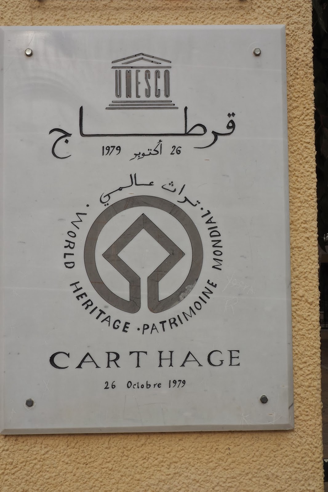
The site of old Carthage was declared a world heritage site by the UN on 26th October 1979. According to the official site for this world heritage: "this roperty comprises the vestiges of Punic, Roman, Vandal, Paleochristian and Arab presence. The major known components of the site of Carthage are the acropolis of Byrsa, the Punic ports, the Punic tophet, the necropolises, theatre, amphitheatre, circus, residential area, basilicas, the Antonin baths, Malaga cisterns and the archaeological reserve."

We were shown first a stele at the site. This is believed to be a monument to Tanit or Tannit or Tannou, a Punic or Phoenician goddess, and the equivalent of the moon goddess Astarte( in Greek Isthar) and later worshipped in Roman Carthage as Dea Caelestis, or Juno Cealestis or simply Caelestis. Even today, it's customary to invoke "Oumek Tannou" (Mother Tannou") in years of drought in this region to pray for rain. She is supposed to be wife of another god of the Canaanite origin. She is worshipped throughout the Western Mediterranean from Malta to Gades up to Hellenistic times. And from about 5th century BCE, her worship was associated with that of Ba'al Hammon and is sometimes described as "pene baal" or the "face of Baal" and is given the title of "rabat" or a "female chief" and is worshipped iin North Africa as an unmarried goddess and nurse and less specifically as a symbol of fertility and even as a heavenly goddess of war. Another site where a monument of her was discovered was at Kerkouane in the Cap Bon peninsula in Tunesia. it is believed that she started life in the pantheon of Ugarit as the goddess Anat, a consumer of flesh and blood and this stele is believed to be evidence her worship is associated with child sacrifice which was openly carried out until the time of Emperor Tiberius according to the North African Christian writer Tertullian. In Roman times, she was worshipped as Juno. In Egyptian, her name means Land of Neith, Neith being a war goddess. Her symbol, a trapezium later simplified into a triangle is interpreted as a woman raising her hand and her horizontal arm is sometimes terminated by two short upright lines at right angle to it or by hooks. Sometimes she is depicted with a lion's head, showing association as a war goddess.


This is where the path terminates in quite close to where the Tanit stele was found. This stone tablet is believed to be the gravestone of a necropolis or a tomb. The two girls there indicate that it's may have been a mass grave for little girls.


This is the site of what is believed to be the graves of the children: there is another grave to its left separated by the broken and overgrown wall.


There are probably the larger and smaller channels for the pools of different sizes through which used water may drain out to the sea below


It was raining just before we arrived. So there are pools everywhere on the floors of the ground floor


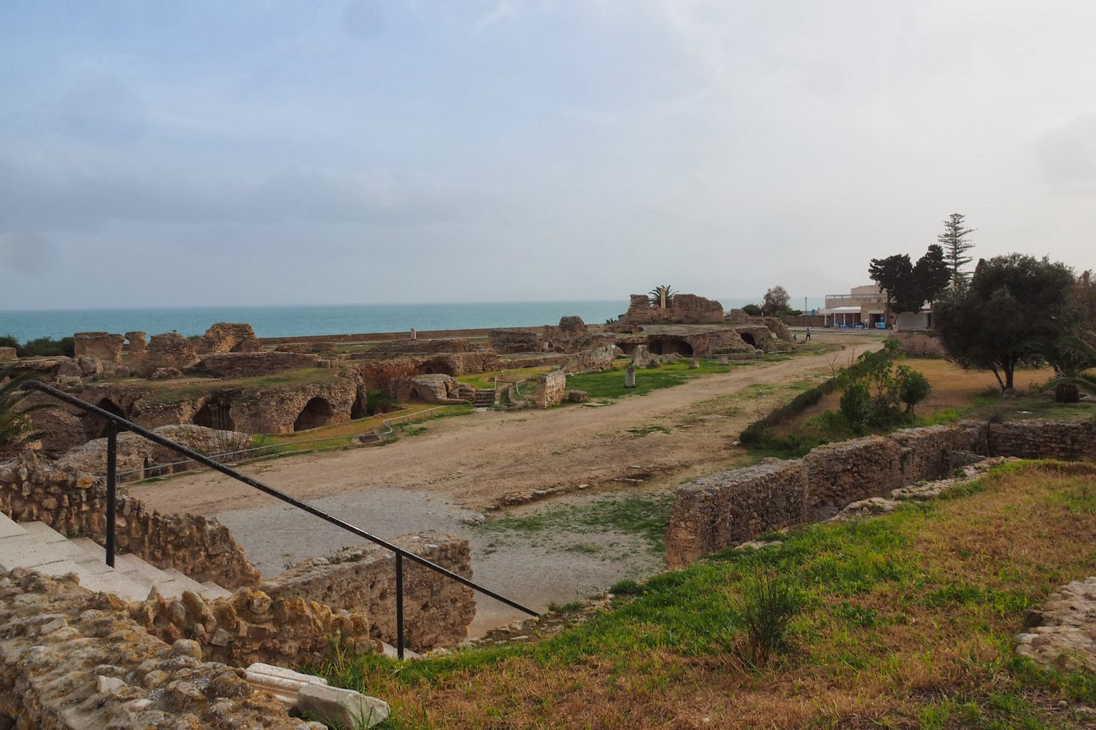
This is the part of the ruins closest to the sea, probably the ground floor of the terrace looking out on to the Mediterranean Sea.


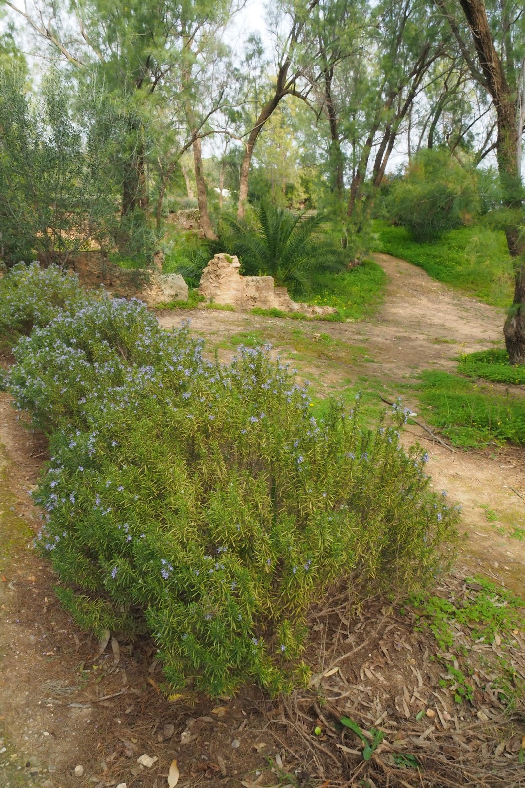
Was it Jesus who told his flock to look at the daisies in the field and said that even Solomon in his greatest days couldn't match their glory? They are free of all worries.
They wouldn't mind where they are growing, just so long as they can grow and thrive.


The success of the Tunisian protests inspired a series of similar mass protests throughout the Arab world in what's been called "the Arab Spring" or the "Jasmin Revolution". The trigger of "the Arab Spring" was the death of Mohamed Bouazzizi, a 26-year-old Tunisian street peddlar who set himself on fire on 17th December 2010 to protest against the confiscation of his goods and the humiliating treatment he got from the municipal officials. He died on 4th January, 2011. But even after Ben Ali fled the country, mass protests continued clamoring for banning the members of the RCD from holding any political office in the provisional government under Mohammed Ghannouchi and a Tunis court banned the ex-ruling party RCD and confiscated all its resources and a ministerial decree banned the "political police" (special branch police formed to intimidate and prosecute political activists). A General Election was held on October 23, 2011,one which and international observers declared the free and fair. The previously banned Ennahda Movement won 90 of 217 parliamentary seats and on December 12 2011, former dissident and veteran human rights activist Moncef Marzouki was elected president and in March 2012, Ennahda declared that it would not support making Sharia (the Islamic moral and religious code of conduct) the main source of its legislation in the new constitution because it maintained that the state which should be secular must be separated from religion. But on 6th February, 2013, Chokri Belaid, an outspoken leftist opposition leader and critic of the Ennahda was assassinated.
We were shown first a stele at the site. This is believed to be a monument to Tanit or Tannit or Tannou, a Punic or Phoenician goddess, and the equivalent of the moon goddess Astarte( in Greek Isthar) and later worshipped in Roman Carthage as Dea Caelestis, or Juno Cealestis or simply Caelestis. Even today, it's customary to invoke "Oumek Tannou" (Mother Tannou") in years of drought in this region to pray for rain. She is supposed to be wife of another god of the Canaanite origin. She is worshipped throughout the Western Mediterranean from Malta to Gades up to Hellenistic times. And from about 5th century BCE, her worship was associated with that of Ba'al Hammon and is sometimes described as "pene baal" or the "face of Baal" and is given the title of "rabat" or a "female chief" and is worshipped iin North Africa as an unmarried goddess and nurse and less specifically as a symbol of fertility and even as a heavenly goddess of war. Another site where a monument of her was discovered was at Kerkouane in the Cap Bon peninsula in Tunesia. it is believed that she started life in the pantheon of Ugarit as the goddess Anat, a consumer of flesh and blood and this stele is believed to be evidence her worship is associated with child sacrifice which was openly carried out until the time of Emperor Tiberius according to the North African Christian writer Tertullian. In Roman times, she was worshipped as Juno. In Egyptian, her name means Land of Neith, Neith being a war goddess. Her symbol, a trapezium later simplified into a triangle is interpreted as a woman raising her hand and her horizontal arm is sometimes terminated by two short upright lines at right angle to it or by hooks. Sometimes she is depicted with a lion's head, showing association as a war goddess.
the way to what some may consider gruesome
the road sign to that path
This is where the path terminates in quite close to where the Tanit stele was found. This stone tablet is believed to be the gravestone of a necropolis or a tomb. The two girls there indicate that it's may have been a mass grave for little girls.
I found this model house on the ground. It looks rather like those terra cotta houses that one finds in certain Chinese tombs.
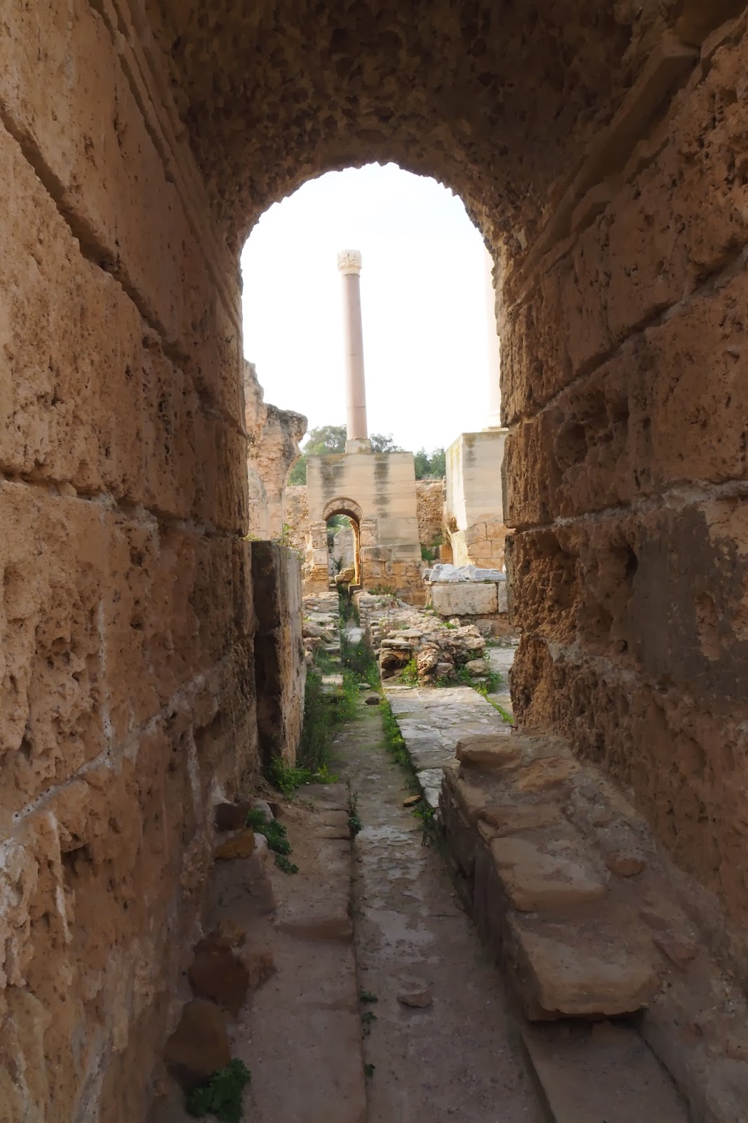
the head of a Roman column at the side of the path
another part of the same path
This is the site of what is believed to be the graves of the children: there is another grave to its left separated by the broken and overgrown wall.
This is the path leading to the Roman baths built in 2nd century CE by the Roman Emperor Antoninus. He built a 132-meter long aqueduct to guide water to the Roman baths.
the remains of another building on the way the Roman bath
the pedestal to a Roman column
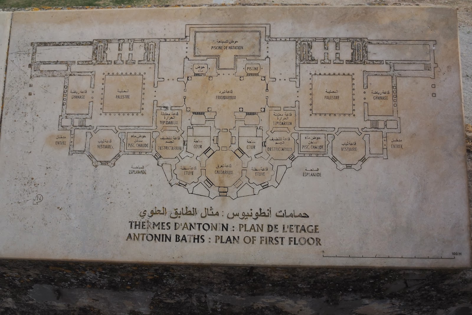
This is a first floor plan of the huge Roman baths. On the highest level, there is a hottest thermal bath, in the form of a big ring in the lowest part of the plan. On each side, there are two areas where they could take a break before proceeding to the next ring lower down on its left or right where they could have their dead skin rubbed away. After that, they could descend to the an descend to the warm baths. The big rectangle in the centre of the plan is where they can have a cold bath. If they desired, they could go and have a swim the T-shape location on top of the plan to have a swim. On each side of the The Romans really know how to enjoy themselves. On each side of the cold bath area, there is a palestre, which is a space where people can receive some instruction or hold discussions. This kind of place is usually found in all places in the Mediterranean affected by Greek culture because the ancient Greek placed a very high premium on the need for education. To the left and right of the palestres, there is a gynasium where if they like, the Romans can have some physical exercise.
the way down to the Roman Baths
Two cats were fighting for space on this staircase
The cat looks quite well fed. I wonder who fed it. Perhaps by the people who ran the cafe a little further down?
The cat was following us around. Perhaps looking for snacks? Sorry, haven't got anything with me!
our first sight of the Roman baths
We're now down to the level of second level below just above the baths
part of the grounds of the Roman baths.
we found many arches just above the level of the path: these are entrances of the resting room after dipping into the hottest baths on the right hand side
This is the cross-section of the plan of the Roman thermal baths
This is an artist's impression of what the Roman bath would look like in its hey day.
The entrance to the thermal baths built by Emperor Hadrian and Emperor Antoninus in the 2nd Century
The Palestre?
This is the changing room on the left hand side
Our passage to the cold baths
some of the passages to the left
This is the bottom of the swimming pool on the ground level.
More passages in this maze of passages on the ground floor level. How many Roman slaves walked through here?
More doors and arches on the ground floor
The space underneath the large swimming pool
There are probably the larger and smaller channels for the pools of different sizes through which used water may drain out to the sea below
The huge column would give us some idea of the height of the former buildings there.
These pillars show how high the roof of the ground floor would be
The pillars have to be quite massive to support the weight above
These arches are solidly built with very thick walls: they had to be to be able to support the huge weight above
A closer view of how the marble columns are aligned
Although nearly 2000 years have passed, these building blocks appear to be as solid as ever but there are inevitable signs of some erosion of the flooring materials.
The fallen remains of former pillars or floor slabs
The fallen slabs are truly massive
The slabs appear to be more than a foot thick
Some of the beautiful capitals of former columns
It was raining just before we arrived. So there are pools everywhere on the floors of the ground floor
The ground floor is paved with little flat rocks serving as floor "tiles"
broken columns on the wet floor. What did they witness while they were still up and about?
Reflections everywhere
the little puddles is what is left of the former swimming pool
Looking out and up the sky and the sea beyond
Nothing but reflections of the open sky and the ruined pillars now overgrown with grass.
brown, red, yellow, smooth, rough, massive, corroded, round, square, high, low: all in ruins.
Other bushes did not waste time colonizing the space vacated by the deserted Roman baths either
This column had its moment of glory too, now resting peacefully, its work done.
They lie there, as if in commiseration of their common fate
These broken marble column ones too gather for company by the side of the more humble granite: all superiority gone, equalized by time.
They are joined by the pedestals, marble or granite
capitals or column,marble or granite, share the same fate. above them rise a crop of trees and bushes. They're the real survirors. They are still living.
I walked amongst the ruins, ruminating.
This is the part of the ruins closest to the sea, probably the ground floor of the terrace looking out on to the Mediterranean Sea.
These two marble columns survived probably because they lay furthest away from the centre of all former attention.
same columns different fates whilst the tiny plant seem able to rise above the fallen ones
No matter how colorful, they are now down
They had to continue standing as surrogates for their fallen friends
These channel looks deep and appears to be sloping towards the further side
This looks like the drain for the used water; they appear to be more shallow probably because they closer to the exit point.
This is probably where the water would drain out to the sea
The tiny holes on top of the wall would be where some of the former pipes might have to pass through
Since they lie closest to the sea, they appear most eroded
Was it the same sun which shone on these wall and steps nearly 2000 years ago?
Judging from their positions, these should be the support for the former "palestre" or "gynasium"
They are closest to the outermost columns
What is this Muslim lady thinking?
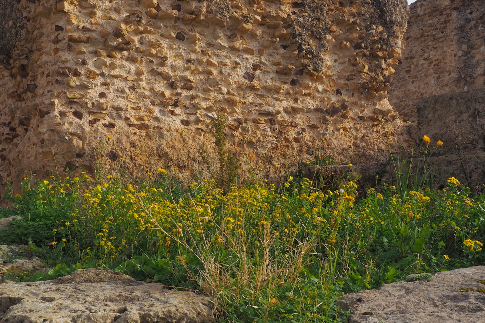
What do these grass and little flowers care?
they'd probably continue to grow towards the sun, for as long as they can.
or if their search for the sun would be temporarily blocked, they'll bide their time.
They know how to live, even if the only space available is a crevice in the rocks
Was it Jesus who told his flock to look at the daisies in the field and said that even Solomon in his greatest days couldn't match their glory? They are free of all worries.
They wouldn't mind where they are growing, just so long as they can grow and thrive.
Even at the mouths of the gutters
back to the former gymnasium
No matter where I went, I found trees and plants: they appear to be the real survivors. perhaps when one day, when human beings have poisoned their water, their air and their food sufficiently to disappear from the face of the earth or kill themselves in a nuclear holocaust, the descendants of these plants will still be around.
What's left of the gymnasium
a pillar and a puddle
Time to look up at the sky. How freely float the clouds.
Clouds above the broken portals
how high compared to the work of man?
Fallen glory
Will two pedestal stones be sufficient to support it?
A column and some stumps is all that is left now
a full view of the former gymnasium
How spacious is the ground in front of it?
A corridor to the sea! how many Roman generals saw the sunset from there?
It was once part of a pedestal?
How blue is the sky?
Steps leading down to the sea
The trident of Poseidon?
Where is the sky in that puddle?
Can you tell me, yellow cat?
Street peddlars on the sidewalk telling me that these are antiques!
Another one telling me the same thing.
Monsieur, since you speak French, I'll give you a good price. The head of Dido, one Dinar!
沒有留言:
張貼留言